

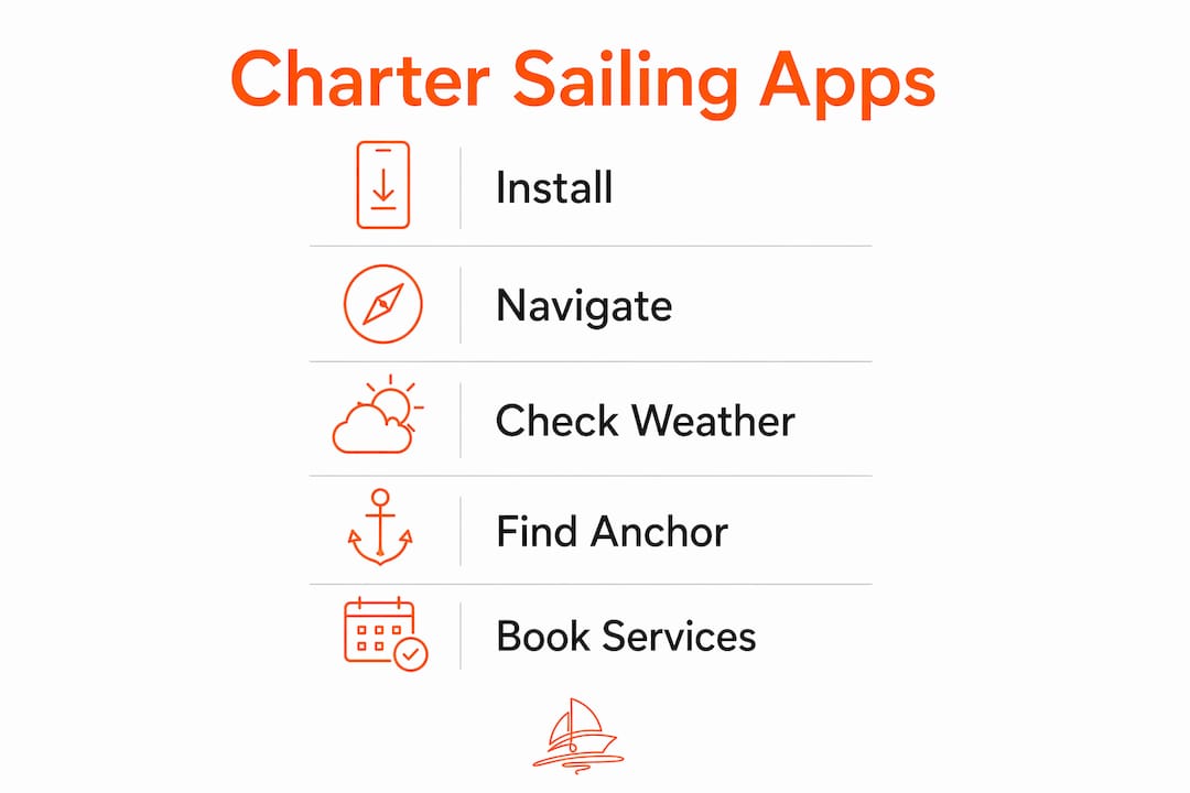
Before you board, install this stack: Navionics for offline charts, PredictWind for weather routing, a MarineTraffic-style AIS viewer for vessel traffic, Garmin ActiveCaptain or Anchorages for berth and anchorage notes, and Sailorix for your booking and add-ons. Cross-check every forecast against the NOAA / National Weather Service before you leave the dock. That five-app combination covers navigation, weather, traffic awareness, anchorage scouting, and booking without overloading your device or your brain.
TL;DR — do this while packing:
- Install your chart app and download the specific coastal region you're sailing
- Cache GRIB weather files on marina Wi-Fi before departure
- Save the marina's VHF channel and phone number offline
- Register your EPIRB and note local Coast Guard contact numbers
- Confirm your Sailorix booking, skipper add-on, and insurance before boarding
Table of Contents
- What are the best apps for sailing, by job?
- How do you set up navigation apps and offline charts for a charter?
- Why should you always cross-check weather apps with NOAA forecasts?
- What do AIS apps actually show, and what are their limits?
- How do you find safe anchorages and reserve a marina berth?
- What safety apps and device setups do charterers need?
- What features matter most when you're renting a boat?
- Which app combinations work best for different holiday trips?
- How were these apps selected?
- Key Takeaways
- Apps are tools, not skippers
- Sailorix membership: lower fees, more control over your charter
- Useful sources and further reading
What are the best apps for sailing, by job?
One app per function keeps things clean. Here's the short list for holiday sailors:
- Navigation/charts: Navionics Boating (iOS/Android/tablet) — offline charts, Auto Guidance, and daily updates; subscription-based with a free tier
- Weather/routing: PredictWind (iOS/Android) — high-res GRIB downloads and departure planning; subscription required for full model access
- AIS/traffic: MarineTraffic (iOS/Android) — real-time vessel positions and names; free basic tier, paid for extended history
- Anchorages/marinas: Garmin ActiveCaptain (iOS/Android/free) — community reports, marina amenities, and hazard notes integrated with Navionics
- Booking: Sailorix — membership-based platform for charter reservations, skipper add-ons, and insurance options
Windy (free, iOS/Android) is a solid backup weather layer for visual wind and wave maps when you want a quick glance without opening a full routing tool.
How do you set up navigation apps and offline charts for a charter?
No single app does everything perfectly. Yachting World's testing found that Savvy Navvy stood out for a routing algorithm that factors current, while Navionics leads on chart breadth and daily updates. For most holiday sailors, Navionics is the practical default: its offline charts cover US coastal waters sourced from NOAA and hydrographic offices, and the Auto Guidance feature plots a basic route around hazards without requiring passage-planning expertise.
iNavX suits sailors who want to load custom NOAA raster charts and prefer manual control. C-MAP is worth considering if your charter boat's plotter uses C-MAP cartography, since the app and plotter can share the same chart database. Savvy Navvy is the best all-in-one pick for charterers who want tides, currents, AIS, and routing in one interface without juggling multiple apps.
| App | Platform | Offline charts | Cost model |
|---|---|---|---|
| Navionics Boating | iOS, Android, tablet | Yes | Subscription |
| iNavX | iOS | Yes (NOAA raster) | One-time + chart fees |
| C-MAP | iOS, Android | Yes | Subscription |
| Savvy Navvy | iOS, Android | Yes | Subscription |
Setup steps before leaving the marina:
- Open the app on marina Wi-Fi and download the chart region for your full planned route, not just the first leg
- Enable plotter sync if the charter boat supports it (Navionics and C-MAP both offer this)
- Set screen brightness high and lock auto-rotation; most marine apps have a night mode for evening passages
- Download chart regions before you lose reliable Wi-Fi — this is the step most charterers skip
Pro Tip: Mount your tablet in a dedicated cockpit holder with a sunshade. Tablets overheat and wash out in direct sun; a $20 sunshade and a power bank rated at 20,000 mAh will keep your nav running through a full day sail.
Why should you always cross-check weather apps with NOAA forecasts?
PredictWind gives you access to multiple forecast models including ECMWF, GFS, and its own proprietary models, plus GRIB file downloads and a departure planning tool that scores windows by wind and sea state. Windy layers those same models on a visual map that's fast to read at a glance. Both are genuinely useful.
The catch: third-party models can miss localized marine warnings. Captains recommend cross-checking high-resolution app forecasts with official NOAA/NWS text forecasts to capture marine-zone advisories and small-craft warnings that a global model may smooth over. The NOAA marine forecast for your specific zone takes about 30 seconds to read and can change a go/no-go call entirely.
Before every departure:
- Download GRIB files for your route on marina Wi-Fi (PredictWind's offshore mode supports low-bandwidth caching for areas with poor connectivity)
- Pull the NOAA marine zone forecast for your cruising area
- Check the 48-hour window, not just the morning of departure
- If the models disagree significantly, treat the more conservative forecast as correct
What do AIS apps actually show, and what are their limits?
AIS viewer apps display the real-time positions, names, speed, and heading of vessels broadcasting an AIS transponder signal. For a holiday sailor, that means you can see a tanker's course before it's visible on the horizon and get a rough CPA (closest point of approach) estimate. MarineTraffic is the most widely used option, with a free tier that covers basic vessel positions.
The limits matter. Shore-based AIS receivers have coverage gaps offshore and in some anchorages. Small fishing boats and personal watercraft often carry no AIS at all. An AIS app is a traffic awareness layer, not a collision-avoidance system. It doesn't replace radar, and it absolutely doesn't replace keeping your eyes up.
- Set a safe-range alarm (typically 0.5–1 nautical mile for coastal sailing)
- If the charter boat has an onboard AIS transponder, pair the app to it for direct NMEA data rather than relying on internet-fed positions
- Maintain a VHF watch on Channel 16 alongside any AIS app
Pro Tip: Pair your AIS app with a physical VHF radio watch. If a vessel's AIS shows it on a collision course, hailing on VHF 16 is faster and more reliable than any app alert.
How do you find safe anchorages and reserve a marina berth?
Community-sourced data is often more current than official charts for anchorages. Navionics community edits and Garmin ActiveCaptain reports can flag a silted entrance or a new restricted zone that won't appear on a chart for months. Always check those notes the day before arrival, not a week out.
For marina reservations, Dockwa covers hundreds of US marinas and lets you book a slip directly from the app. ActiveCaptain shows amenities, fuel availability, and user reviews. For anchorages, the Anchorages app aggregates community depth reports and photos.
Anchoring approach checklist:
- Check the app's reported depth against your boat's draft, with a safety margin
- Confirm the seabed type (sand holds better than weed for most anchors)
- Calculate swing room based on your rode length and neighboring boats
- Check local restrictions — some anchorages near marine parks have seasonal no-anchor zones
- Read the two or three most recent community reports, not just the highest-rated one
For charter-specific bookings, look for apps and platforms that surface insurance options, skipper add-on availability, and cancellation terms upfront. A booking that buries the refund policy in fine print is a problem when a weather window closes your trip early.
What safety apps and device setups do charterers need?
Safety tools on a charter boat start with the hardware: a registered EPIRB, a working VHF radio, and flares. Apps support those, they don't replace them.
- NOAA Weather Radio / NWS alerts: set up push notifications for your cruising area's marine zone before departure
- VHF companion apps (such as the US Coast Guard's app): useful for DSC channel reference and distress procedure reminders
- Live location sharing: share your float plan and a live GPS link with someone ashore before leaving the marina
- Keep battery reserve above 30% on your navigation device at all times; carry a power bank
Pro Tip: Save an offline copy of emergency contacts, your EPIRB registration number, and the local Coast Guard sector phone number in your phone's notes app. If you lose data signal, that file is still there.
What features matter most when you're renting a boat?
Charter sailors have different needs than boat owners. You don't control the hardware; you may have limited time to learn a new app, and you need everything working before you leave the dock.
Charter-friendly feature checklist:
| Feature | Why it matters for charterers |
|---|---|
| Offline chart download | No marina Wi-Fi once you're underway |
| Simple autorouting | Reduces setup time on an unfamiliar boat |
| Integrated marina contacts | Quick berth booking without switching apps |
| Clear subscription model | Avoid surprise charges mid-trip |
| Plotter compatibility | Sync with charter boat's existing hardware |
| Insurance/skipper add-on visibility | Know your coverage before you cast off |
When evaluating a booking platform, confirm the cancellation and refund policy before paying. Weather-related cancellations are common, and a platform that offers flexible terms protects your trip budget. Sailorix surfaces insurance and skipper add-on options at booking, so you're not hunting for them separately.
Which app combinations work best for different holiday trips?
Experienced mariners favor a multi-app setup over a single all-in-one tool, because redundancy matters when one app fails or loses signal. Keep the stack small, though: three to four apps is the practical limit before battery drain and screen-switching become their own hazard.
Day cruise: Navionics (offline charts) + Windy (quick weather visual) + MarineTraffic (AIS)

Multi-day coastal cruise: Navionics + PredictWind (GRIB routing) + ActiveCaptain (anchorages) + Sailorix (booking and add-ons)
Family charter: Savvy Navvy (all-in-one, simple UI) + Windy + Dockwa (marina reservations)
To run these together without killing your battery, download all charts and GRIB files on marina Wi-Fi, then switch your device to airplane mode with GPS on. Turn off background refresh for every app except your active navigation tool.
Pro Tip: Dedicate one tablet purely to navigation and keep your phone for communication. Running nav, AIS, and weather on the same device that handles calls and messages drains the battery faster and creates distracting notifications mid-passage.
How were these apps selected?
Apps in this guide were evaluated against five criteria: use of official chart sources (NOAA, hydrographic offices), offline capability, weather model access, community update frequency, and app-store credibility based on user review volume and rating consistency.
Recommendations prioritize holiday-sailor usability over advanced passage-making features. Safety-first checks, specifically the NOAA cross-check and captain go/no-go practice, are weighted heavily because charterers often sail in unfamiliar waters without local knowledge.
"No single navigation app does everything. The best approach for holiday sailors is a small, interoperable stack: one chart app with offline support, one weather tool cross-checked against official forecasts, and one community anchorage source. Redundancy is the point." — Yachting World, Best navigation apps tested
Primary sources consulted:
| Source | Used for |
|---|---|
| Yachting World app reviews | Navigation app comparison and device precautions |
| NOAA / National Weather Service | Official forecast cross-check guidance |
| PredictWind Play Store listing | GRIB and routing feature details |
| Navionics Play Store listing | Offline charts, community edits, subscription model |
| Savvy Navvy Play Store listing | All-in-one feature set and offline capability |
| Captainsword.com | Go/no-go weather decision guidance |
Key Takeaways
A compact, offline-ready stack of four apps covers every critical function for a holiday charter: navigation, weather, traffic awareness, and anchorage scouting.
| Point | Details |
|---|---|
| Install before you leave | Download chart regions and GRIB files on marina Wi-Fi; you won't get a second chance offshore. |
| Always cross-check weather | PredictWind or Windy plus the NOAA marine zone forecast together catch what either misses alone. |
| AIS has real limits | MarineTraffic shows transponder-equipped vessels only; keep a visual lookout and a VHF watch. |
| Community notes beat static charts | Check ActiveCaptain or Navionics community edits the day before entering an anchorage or marina. |
| Sailorix handles the booking layer | Use Sailorix to confirm your charter, add a skipper, and review insurance before you board. |
Apps are tools, not skippers
Every app on this list is genuinely useful. But the most common mistake holiday sailors make is trusting a screen more than their eyes. A chart app shows you where the rocks are charted; it doesn't show you the uncharted lobster pot buoy at the entrance to the anchorage. Community reports are often more current than official charts, but they're still written by strangers who may have arrived in different conditions.
Keep devices charged, cross-check community anchorage reports against what you actually see on approach, and treat every app as a second opinion rather than the final word. The fixed chartplotter on the charter boat is your primary navigation reference. Your phone is the backup. That hierarchy matters most when things go wrong.
Sailorix membership: lower fees, more control over your charter
Most charter booking platforms charge 10–20% service fees on top of the boat price. Sailorix works differently: a single annual membership at €100 per year lowers your service fee to about 1%, so frequent charter sailors save significantly over the course of a season.
Beyond the fee structure, Sailorix lets you book skipper add-ons, review insurance options, and check real-time availability across a global fleet, all in one place. For holiday sailors who charter more than once a year, the membership can quickly offset standard booking fees. If you're planning a coastal cruise and want the booking side handled cleanly before you focus on your app stack, browse available yachts on Sailorix and lock in your dates now.
Useful sources and further reading
- NOAA Marine Forecasts — official US marine zone forecasts; bookmark the page for your cruising area
- Yachting World: Best navigation apps tested — independent review of leading chart and navigation apps
- PredictWind on Google Play — full feature list and model access details
- Navionics Boating on Google Play — offline chart specs, subscription tiers, and community edit details
- Savvy Navvy on Google Play — all-in-one feature set including NOAA-sourced US charts
- Captainsword: Top sailing apps — practitioner perspective on go/no-go weather decisions
- Sailorix affordable sailing trip guide — pre-departure checklist and budget planning for charterers